

")


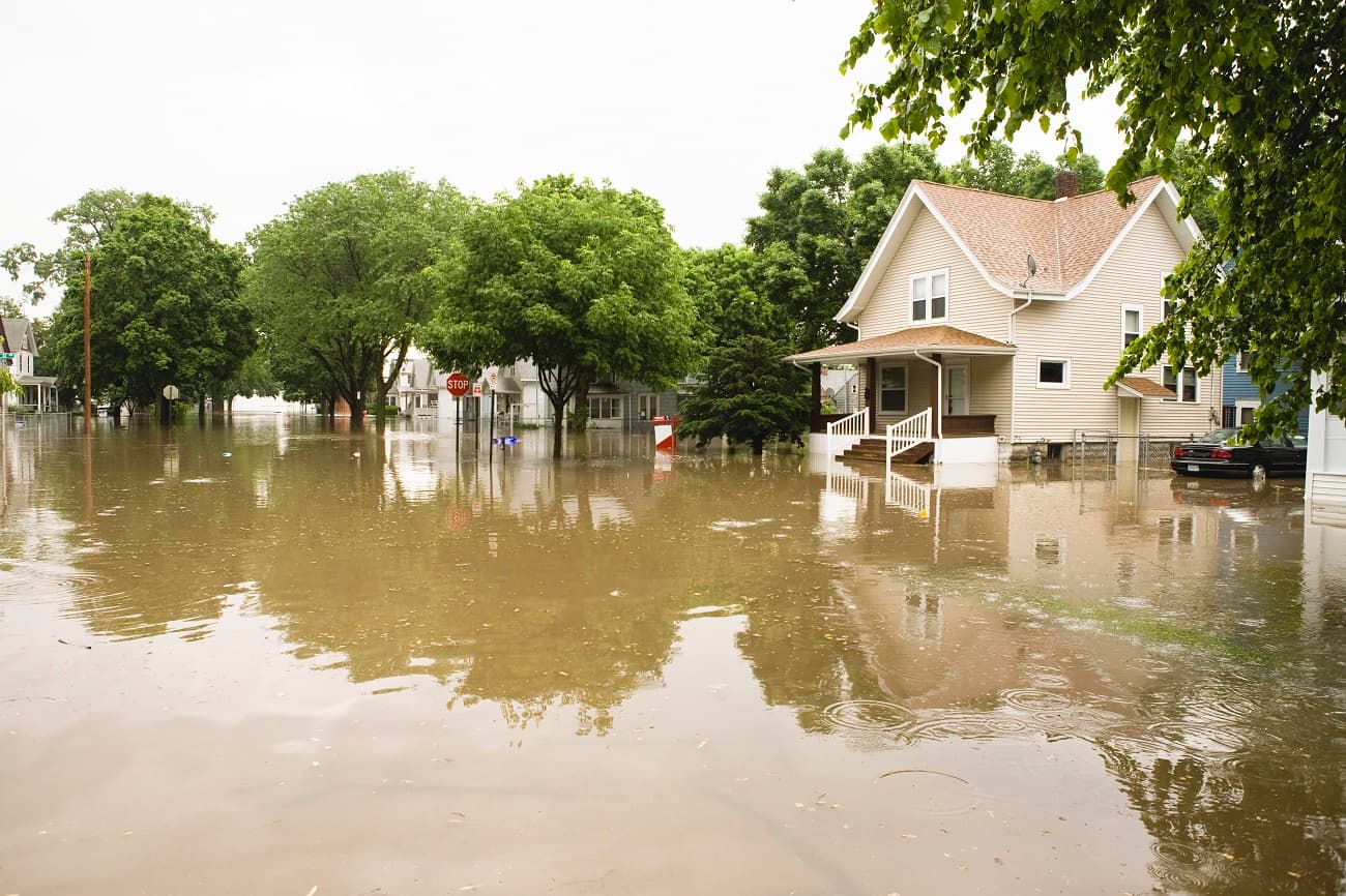
Many homeowners dream of living at the water’s edge—until a catastrophic hurricane like Katrina or Sandy upends their lives. As federal and state government may be less able to help than in the past, it can become a story of haves and have-nots. Those with means can raise their homes on stilts or retreat to their other home if their beach house gets flooded. But those with lower incomes may live in flood-prone areas because that’s where they can find affordable housing.

The damage from rising waters will affect more and more people. By 2100, at least 13 million Americans will be displaced by sea level rise, according to projections by the University of Southern California. According to a 2022 analysis, Inequitable patterns of U.S. flood risk in the Anthropoce, Wing, O.E.J., Lehman, W., Bates, P.D., et al, flood risk patterns across the United States are changing rapidly. Within 25 years, average annual flood losses are projected to increase by over 26 percent due to intensifying rainfall, sea level rise, and more severe tropical cyclones. And the risk is not shared equally.
According to the analyses, using Census data, currently, the highest flood risks are borne by poorer, predominantly white communities in rural areas.
However, as extreme weather events alter the hazard landscape, Black communities—especially in the Deep South—are expected to see disproportionately greater increases in risk. In addition, without changes in land-use policies and planning practices, population growth and development in flood-prone areas could potentially quadruple flood exposure as compared to extreme weather alone.
The study shows that Federal Emergency Management Authority (FEMA) maps vastly underestimate risk and fail to capture the majority of U.S. flood risk. Nearly 60 percent of national flood damages occur outside officially mapped zones. The report shows that current federal relief and resilience programs often favor wealthier, white communities and advocates for urgent reform in U.S. flood risk management, emphasizing the need for equity-focused adaptation strategies.
Targeted investments in risk reduction, relocation, and retrofitting must prioritize the communities most vulnerable now and in the future.
Transparent, accessible flood information and current data can guide smarter development and protect vulnerable populations as risks escalate, the study concludes.
Buying and owning a home becomes more complicated when weighing the risks of extreme weather events, location, development patterns and costs. Part of the problem: “Climate risks are not reflected in home prices, so the market is not sending the right signals on risk,” said an official at the Lincoln Institute of Land Policy in Cambridge, Mass. “Having climate risks more accurately reflected in property values would start to send the right signal,” he said. “You have to be really deliberate and careful.”
There are two ways to deal with the overall problem, he said. Either developers can build more affordable housing in areas less vulnerable to extreme weather events, or homes in flood-prone areas can be made more resilient. There’s no reason not to pursue both.
Adding Resilience to Affordable Housing
The National Housing Trust (NHT) in Washington, D.C., is working to make affordable housing more energy efficient and resilient to disasters. To reduce the need for carbon-based, nonrenewable resources in those communities, it has installed 13-megawatt solar panels on several properties in D.C, said Eugene Capp, codirector of Energy Solutions at the NHT. The properties pay a reduced power rate for low-income housing. “We started this to make sure the housing itself was sustainable,” said Josh Earn, managing director of lending and innovation at the Housing Trust. “Energy is the largest cost.”

NHT in Washington, D.C., is working to make affordable housing more energy efficient and resilient
“The next step is the resilience of the properties themselves,” said Earn. In the next year or two, the Housing Trust will install batteries and resilience hubs on several properties. The goal is to ensure that in an emergency such as a power outage, there’s enough energy to keep residents’ medication refrigerated, charge their electronic devices, power an oxygen system, and cover other essential needs for 72 hours. A resilience hub, which serves an apartment building, takes up an entire room in the basement.
The housing in question is not technically in a “special flood hazard area” on a FEMA map. FEMA only maps along some major rivers and the coast, but properties along the Anacostia River near the city’s large reservoir have a flood risk. As an example, most people didn’t think of Houston as a flood-prone area until Hurricane Harvey hit, dumping 50 inches of rain in a seven-day period and causing catastrophic flooding to the city and surrounding areas, including areas outside of designated flood zones.
Neighborhood education is part of the process, said Earn. “When we started, there weren’t solar panels in the neighborhoods where we were installing them,” he said. “We were going into people’s homes. There was some skepticism. Then they saw it was successful.” What really convinced people was seeing an average $25 monthly reduction on their electric bill.
Community Resilience Hubs in New Orleans
In New Orleans—a city all too familiar with resilience—the group Together New Orleans created the Community Lighthouse Project, a planned network of 85 congregations and community institutions across the city. Each of them will be a resilience hub, providing commercial-grade solar power and backup battery capacity during a power outage or natural disaster. Some churches have installed solar panels on their roof—a money saver in normal times and a potential lifesaver during a power outage.

After Hurricane Francine caused power outages in the city in September 2024, close to 2,300 residents were helped by nine of the initial Community Lighthouse hubs. One older resident was able to charge his oxygen machine at the local church, then return home to sleep, according to an AP report. The hubs can act as locations for FEMA and the Red Cross to distribute food and supplies. The goal is for every city resident to live within a mile of a Lighthouse hub. Eventually, there will be 500 hubs across the state.
Investment in Resilience Helps Property Values
Other ways to increase the resilience of neighborhoods on the water’s edge, said the Lincoln Institute official, are stricter building codes, sea walls, and green stormwater infrastructure. The obstacle is often funding, but even more modest measures like rain gardens and improvements to the stormwater drainage systems can help. “The case we try to make is that these investments have positive impacts on property values, economic growth and people’s safety,” he said. “It pays to look at it in the long run.”
One way to fund these investments, he said, is to look at land value capture, which leverages the anticipated increase in property values to start projects that increase resilience.
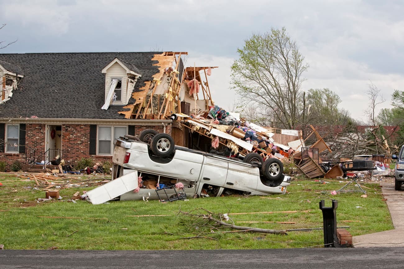
The Lincoln Institute has also studied the equity implications of fast and slow relocations. Slow relocations are done by those who can see, for instance, that after five years of flooding, extreme weather is starting to affect their property. They have the means to move somewhere less risky.
Fast relocations happen in a hurry when people’s homes—often those in low-income areas—are flooded and residents are forced to evacuate. The nation watched in horror what happened to the Lower Ninth Ward in New Orleans. Many of those residents—who were disproportionately Black — never returned to the city after their homes were destroyed.
Planning for the Long View in Louisiana
The Center for Planning Excellence (CPEX), a statewide nonprofit planning group based in Baton Rouge, La., looks at the long term. “In Louisiana, for the longest time, planning was pretty unpopular,” said Camille Manning-Broome, the group’s executive director. “The tipping point was Katrina and Rita in 2005. Those disasters exposed our vulnerabilities. Our environment is changing, and our development planning is not prepared.”
In Louisiana, “we’re not resilient because we want to be, but because we have to be,” she said “We have severe poverty and poor public health outcomes. A lot of our economy is tied to industries that produce greenhouse gases but that the rest of the nation needs.”
CPEX has worked with the state to help the most at-risk communities plan for resiliency. “It was the first time that many of those communities had seen maps that combined sea level rise data with flood data,” said Manning-Broome. “We see areas completely under water when we get to 2050. A lot of major sea level rises are going to take place.” The process has started those communities talking about planning for their future.

“They already know the level of risk because they’re going through death by a thousand cuts,” Manning-Broome said. “Most households across our coast have had to let go of insurance because the rates are too high. Then there are also challenges in the fishing industry to our coastal area.”
In Louisiana, most of its economies are about access to the water.
But for many Louisianans, leaving the water’s edge is not a serious option. “Most of our economies are about access to water and the type of water,” said Manning-Broome. “Whether fishing or sailing, fresh or brackish waters.
“The city is building more resilient infrastructure, especially better stormwater management systems. At the community level, New Orleans has a program for homeowners to replace their driveways with permeable surfaces that will absorb rain instead of causing it to run off.”
The biggest challenge, said Manning-Broome, is that no one sees themselves as responsible. “Not the feds, state or local government. It’s all left to the individual homeowner. We need a more collective frame and understanding of responsibility.”
What Would a Stormwater Fee Do?
The Water Collaborative, a New Orleans nonprofit, which promotes equitable and sustainable solutions for living and thriving with water, is trying to take a broader view. The group is “centered around the fact that water is a human right,” said Joey Algier, narrative strategy and education manager. The group is pushing to add a vote on a stormwater fee to the city’s November ballot.
The problem is that currently, only homeowners pay that fee, as a percentage of their property tax, said Algier. Entities with nonprofit status, such as Tulane University and the Superdome, don’t pay it. A stormwater fee for everyone would “create an equitable fund that’s transparent and accountable to residents,” he said. It would help the state create its own source of funding, so it doesn’t have to depend on federal money.
“A large part of the opposition is, who gets to control the money,” said Algier. “No one is on the side of flooding. The Sewer and Water Board want to create their own stormwater fee. They want to focus it into gray infrastructure,” such as sea walls and dams. Green infrastructure includes measures such as bioswales, community gardens and rain gardens, which would cost much less and improve the quality of life in a very hot city.”
True Cost of Flooding
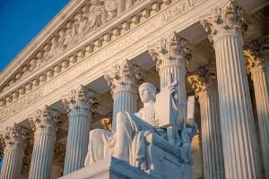
Austin Perez, senior policy analyst for insurance issues at the National Association of REALTORS®, brings it back to insurance and to the long view. “Most people don’t believe a flood will happen to them until a big storm like Katrina, Sandy or Harvey,” Perez said. “According to FEMA, the flood maps don’t reflect the full risk, so consumers shouldn’t rely on them to assess a home’s flood risk.”
The risk of disaster, especially flooding, is simply not being factored into the true cost of homeownership. University of Pennsylvania Wharton Real Estate Professor Benjamin Keys has been studying this for more than a decade. He has concluded in a time of decreasing affordability, the cost of insuring against a catastrophic event can put one more squeeze on homebuyers.
Keys is updating a paper he authored that looks at flood-prone coastal properties and whether sales will slow because of staggering insurance hikes. “A number of studies suggest that these risks are not the first thing that homebuyers consider. There are a lot of reasons why homeowners are not aware of the risk or do not appreciate the risk. In some states, sellers are not required to state prior flood damage or the flood risk to a property,” he said.
Keys said when buyers are calculating their monthly payment, they must look at what insurance will cost a decade from the time of purchase. In the past several years, rates have skyrocketed much more than the rate of inflation. Part of that is because in the past year, there have been 27 disasters that did more than $1 billion in damage, so the insurance industry is reacting to those losses. The National Flood Insurance Program, which provides most of the flood insurance to homeowners, is increasing rates at 18 percent per year to reflect the actual risk of flooding.
While this impacts everyone, it can be devastating to low-income people. When a lender considers a higher insurance premium over the life of the loan, it could keep the would-be buyer from qualifying. Even for longtime homeowners who have paid off their mortgage and seen decent appreciation of their value, spiraling insurance rates may force them to drop coverage they cannot afford.
“These are tough choices for those on a fixed income,” Keys said. “We think of homeownership as a way to lock in our costs … It’s desirable relative to renting, where a landlord can jack up the rent each year. But now property taxes have gone up in [vulnerable] areas, to fund infrastructure to combat flooding and these areas also have seen a sharp insurance rate increase. A lot of homeowners don’t understand flood is not covered by primary insurance, and they don’t realize flood maps are drawn in highly political ways and don’t account for all types of flood-related risks.”
While many want to blame insurance companies for high rates, growth patterns that place people closer to risk, in an environment with many more costly disasters, is a major factor. “We’ve been moving southward as a country for years now. We’ve been moving into riskier areas,” he said, noting dense development in coastal, warmer areas. “Where we’re choosing to build and to live is the biggest driver in the increase in insurance cost.”
First Street, an organization that uses more comprehensive climate science and engineering approaches to quantify and communicate the risk for every property in the country, and other tech and science organizations have estimated that at least 10 million homes have a high flood risk but are not reflected on FEMA’s map or required to buy flood insurance. That helps explain why one third of claims to the NFIP come from outside the special flood hazard area.
“FEMA’s maps don’t show all flood risks, like heavy rainfall,” Perez said. “For example, most of the damage from Hurricane Harvey happened in Houston after it was no longer a hurricane. Harvey dropped 4-5 feet of water in less than a week, causing damage mostly to properties in low-lying areas, not near rivers or oceans.”
The more accurate way for consumers to understand the risks of a property is to get a full-risk quote from the National Flood Insurance Program.
The more accurate way for consumers to understand the flood risk to a property is to get a flood insurance rate quote from the National Flood Insurance Program, either through a specialized flood insurance agent or through the online rating tool found on floodmsart.gov.
From insurance rates to property values and affordable housing to land use, equity must be a factor in planning for the changing climate. Extreme weather events disproportionately impact vulnerable communities, exacerbating existing inequalities based on race, income, and other factors, leading to a lack of equity and fairness in disaster impacts and responses. Communities are looking to resilient strategies to address the needs of all.