

")


Fiscal times are tough and getting tougher. Local governments looking for dollars to maintain aging infrastructure are increasingly coming up short as states pull in their budgetary horns, the federal government yanks back previously assured funding and their own tax bases erode amid economic uncertainty. Gas tax revenues that used to rise inexorably are nearing a fiscal cliff as hybrid and electric vehicles claim a rapidly rising share of the vehicle fleet.

The biggest bills are coming due for the localities that saw rapid, spread-out growth in the latter half of the last century. “The obligation to maintain all this infrastructure from sprawl is coming home to roost,” said Owen Bailey, director of land use and policy at the Eastern Shore Land Conservancy, an organization working with a number of jurisdictions to plan for less costly growth. “Local governments are looking for answers in the places they are used to looking and not finding them. The link among all these things is land use.”
The fundamental conundrum is that “sprawl” — with its characteristic commercial roads lined with parking lots and residential streets ending in dead-end cul de sacs — requires more infrastructure to maintain while generating less tax revenue than it costs to do so. And when big box stores fail or move on and home values stall, as is happening increasingly in aging suburbs, revenue gets even tighter. The story has played out similarly all over the country, said Christopher Goodman, a professor of public administration at Northern Illinois University and author of the 2019 study, “The Fiscal Impacts of Urban Sprawl: Evidence From U.S. County Areaspdf.”

In Goodman’s view sprawl is development that is artificially cheap. “My economist’s definition of sprawl is ‘suburbanization that wouldn’t happen unless the public costs are externalized,’” he said. “It wouldn’t get built if developers had to internalize all the costs, such as the value of lost farmland and open space, the longer commute times, maintaining and operating the infrastructure, police and fire services.” He summed up the issue in a blog post on his research: “Spacing development far apart means needing more ‘stuff’ to effectively provide public services; more police cars, fire trucks, miles of sewer lines, or garbage trucks. In general, I find that more compact development (think mixed-use medium rises) is less costly to provide public services.”
There is a reason the sprawl doomsday clock begins ticking in the latter 20th century, said Chuck Marohn, founder and president of “Strong Towns,” a national nonprofit dedicated to helping localities achieve financial resiliency. “At the end of the Depression and World War II, when we demobilized troops and shut down the industry of war, there was a fear we’d go right back to 1935 in mid-Depression,” Marohn said. “Instead, we put our national might into building a new version of America. We turned suburban development into an engine of growth and said if we pump money for highways, housing, and public infrastructure and facilitate the growth of mortgage and consumer debt mechanisms, we can supercharge the economy.” This hyper-sprawl model is unique to the United States, he added. “If you look around the world, other places have cars and home loans but not our pervasive development pattern. Something here is unique, and to me what we were doing was rigging the game to promote outward growth.”
Measuring costs and earnings per acre
The literature underscoring the fiscal costs of sprawling development is plentiful, going back to a 1974 report from the Nixon administration fittingly dubbed “The Costs of Sprawl.” In 2013, Smart Growth America (SGA) surveyed 17 subsequent studies and found that more compact growth costs over a third less for new construction of roads, sewers, water lines and other infrastructure than typical spread-out development. The survey also found an average savings of 10 percent on police, ambulance and fire service costs. Meanwhile, denser development in a traditional, walkable pattern can generate 10 times more tax revenue per acre than conventional suburban development.
Despite this record, however, “There are very few cities that are directly thinking about fiscal impact of development in that way,” said Michael Rodriguez, research director at SGA. “We talk to local officials who are familiar with concepts, but they don’t expressly act on them.” A growing number of communities, though, are getting to fiscal stability while pursuing other goals. “When they are planning their communities, they are thinking about mixed use, complete streets, or walkability, and they are getting the same results, even if they aren’t making the fiscal argument.”
From Joe Minicozzi’s perspective, the fiscal trick is to maximize the tax yield per acre of land while minimizing the costs of delivering infrastructure and services to that land. His Asheville, N.C.-based consulting firm, Urban3, helps communities analyze both sides of that equation, and makes heavy use of visual aids to show the relative revenue and costs for each development pattern in a community, from the most car-oriented sprawl to the traditional downtown. “Cities have a raw material called land,” he said. “Their product is the tax base that grows on top of that land. The best way to measure that value is on a per acre basis,” akin to evaluating a car based on miles per gallon. Inevitably, their research shows that the denser, more mixed-use portions of town are the cash cows, while the spread-out zones are over-consumers of resources. Another consistent observation, he said, is that “sprawl” predetermines and limits an urban form that doesn’t grow naturally into something that gains value over time, unlike traditional compact, walkable development. Cities respond to the data they find sometimes by working to turn shopping centers and parking lots into mixed-use development. In the extreme case of Memphis, Tenn., the city is “de-annexing” sprawling areas that cost more to maintain than they bring to the tax base.
Eugene, Ore., weighs costs and benefits of expansion
n most states, communities are apt to find development happening on the fringe of their jurisdiction without much — or any — conversation about the form it takes. Oregon state law requires cities to establish “urban growth boundaries” and undergo a process and public discussion before expanding the limits for new development. But the state also directs cities to plan for a certain level of population growth. In the case of Eugene, that means accommodating 30 percent more inhabitants in the next 20 years, said Will Dowdy, Eugene’s community development director. “We need a land-use strategy for dealing with that growth.” In many places, it would be a given that this growth required significantly more land, but Eugene opted for a careful analysis of costs and benefits before deciding whether and how much new land to open up. “In Eugene we’re protective of surrounding farmland and have not been aggressive in expanding our urban growth boundary, but we are looking at a housing challenge that could cause us to expand in the coming decade.”

Despite the existence of a growth limit, many parts of Eugene had developed in a typical suburban pattern, Dowdy said. However, local officials began to wonder whether that was a good idea for future growth. Eugene began by doing its own analysis of tax yield per acre and mapped the areas of town with the development patterns that produced more and less revenue. But city leaders wanted to go further to understand the costs with each pattern and hired Minicozzi’s firm to aggregate and map them.
Urban3’s report began by noting that Eugene is less dense today than in 1960, despite the growth boundary, and that roughly three-quarters of their road network had been built since then, with many streets now in a third “rebuild cycle.” Minicozzi notes that roads are termed “assets” under accounting guidelines, but the jurisdictions that must maintain them should understand them as liabilities. That is especially true of the cul de sacs and dead ends that serve only a few property owners and make up 9 percent of Eugene’s road system. In examining the sewer system and wastewater management, Minicozzi noted everyone in the city pays the same per-gallon charge, but there are more pumping stations in the sprawling areas, and more feet of pipe per person to maintain. In a comparison of a downtown neighborhood to a less dense area nearby, the downtown zone had double the dwelling units and one-fourth the feet of pipe per person, while the replacement cost for the less dense node was nearly double. But the tax yield in the denser area is 70 percent higher. In low-density areas of 4.5 residential units per acre, “You’re losing $1,381 per acre,” Urban3 told city leaders. At a medium density of 26.6 units per acre the city is $1,500 in the black, and at 114 units the city takes in more than $3,000 per acre over costs associated with that area.
“Having this understanding of tax revenue versus costs has been helpful” in deciding whether to expand, by how much and with what development pattern, Dowdy said. “What this conversation does is point out that there are costs beyond farmland-versus-houses. In the past, it was assumed expanding got houses and money, but now we see that we lose money and farmland. Everything points to a conclusion that outward expansion is a loser financially. This analysis has reinvigorated the way we talk about the downtown. It is the highest performing tax area in the city, so when we talk about potential investments we can show we’re taking care of the golden goose. It’s not wasteful or special interest; it’s in the interest of the community as whole.”
Calculating costs in rural and urban Maryland
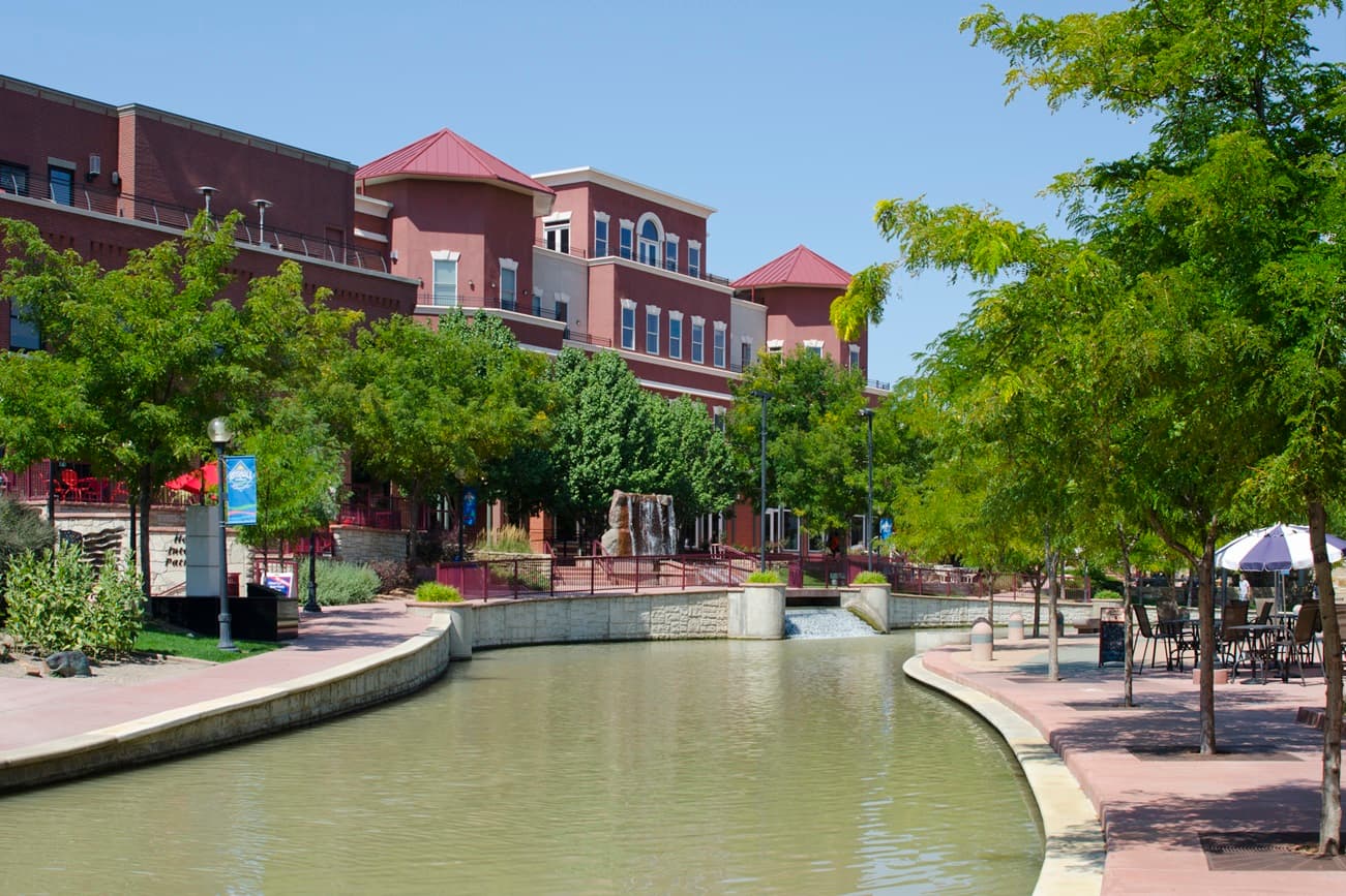
Annapolis, Md., not only has a cherished, traditional urban core, but with a birthdate in the 17th century, the city of 40,000 also has one of the nation’s oldest. Nevertheless, when sprawl came calling in the mid-20th century, city leaders opened the door wide. “In 1951 we expanded ten-fold, into agricultural and minimally developed areas,” said Eric Leshinsky, Annapolis’s chief of comprehensive planning. “We then built out the streets and infrastructure to support development, but a lot of that was typical postwar style.” By the 2020s, when the city was considering how to shape future growth in its state-required comprehensive plan, Annapolis was having second thoughts. “The reality is a lot of it doesn’t pay for itself and is costly to maintain,” Leshinsky said. “The city over the last few years has realized there are quality-of-life and health costs associated with this style of development too.”

City planners brought in Urban3 to map the tax value for various neighborhood patterns, and though they expected downtown to perform well, were surprised at the scale. “I don’t think of Annapolis as the poster child for sprawl, but one thing the analysis proved out is that the city’s history of expansion had created a deficit in the way we fund infrastructure,” said Leshinsky. “The money shot was to show that everything prior to 1951, the city’s original town footprint, a tenth of the city, and the densest and most sought-after area near the waterfront is subsidizing the rest of the city.”
Despite the critical importance of the historic town core, Minicozzi said, “The pre-51 city has a lot of vacancy and needs infill, and in the suburban areas, 79 percent of land is net negative per acre,” when comparing infrastructure and service costs to tax yield. “We recommended they build village centers, a main street with 3- to 4-story buildings.” The city’s plan takes those recommendations into account, said Leshinsky. “We won’t be razing whole corridors for monster redevelopment, but we have some large, aging shopping centers that might transition to a more mixed-use center. The evolution from sprawl will be incremental, but each new increment should provide more revenue and come closer to paying for itself.”
Making the fiscal argument for preserving farmland on the Eastern Shore
Across the Chesapeake Bay from Annapolis, a series of towns peppering the Eastern Shore are assessing their own approach to managing the costs of sprawl. The mostly rural Eastern Shore is connected to the Western Shore and outer suburbs of Annapolis via the Chesapeake Bay Bridge, first opened in 1952, with a second span completed in 1973. While development began to take off after 1952, that second span opened the floodgates for rapid, car-centric development, said Owen Bailey, director of land use and policy for the Eastern Shore Land Conservancy. It was that unchecked sprawl and the specter of losing prime farmland that birthed the Conservancy in 1990, with a goal of preserving land and protecting sensitive natural areas. “By 2010, we realized that though we were very successful at protecting land, we weren’t successful at showing communities an alternative way to grow and develop,” so the Conservancy added a program of providing planning resources to Eastern Shore towns, Bailey said.

The fiscal implications of previous growth have come to the fore as local budgets sag under the weight of upkeep obligations. “We are seeing an infrastructure maintenance crisis,” Bailey said. Transportation revenues, especially for maintenance and overhaul, are falling farther and farther behind the need. “In Maryland, 5 of every 6 miles of roads are owned and maintained by local governments. The state took the funding that used to go to them and the money has never come back,” he said.
In 2024, the Conservancy commissioned Urban3 to perform a fiscal analysis for the towns sprinkled across eight Eastern Shore counties with a total population of 450,000. The goal was to examine “how land-use choices influence the fiscal health of communities across eight counties … [and] to assist local communities in identifying areas to prioritize growth and look towards the future.”
“The value-per-acre analysis showed that the historic town cores were what was bringing value, but [the jurisdictions] had made it illegal to replicate them,” Bailey said. Local land-use regulations all but mandated sprawl. The Mayor of Salisbury, Jake Day, especially took the findings to heart. “They used to call it Sprawlsbury,” Bailey said. “Their waterfront was all parking lots.” After the fiscal report, the mayor started an effort to grow the town center cash cow by bringing residential development downtown. One result was the Ross Apartment building, which now is second only to the Montecarlo Hotel in Ocean City — the largest building on the Shore — in value per acre.
Rancho Cucamonga confronts its legacy of sprawl
Forty miles east of downtown Los Angeles in suburban San Bernardino County is the city of Rancho Cucamonga formed in 1977 from three unincorporated communities looking to create a local government to manage surging development. “We are a natural location for sprawl, and the communities didn’t like seeing the unplanned growth,” said Matt Burris, the city’s deputy city manager of community development. “They were getting a lot of houses, but without sidewalks, parks or other amenities.
“From 1980 to the early 2000s, we were focused on being a great suburban community,” following the model of master-planned areas like Irvine. Though the three founding communities each had a tiny downtown, they opted for a car-oriented pattern rather than build on that compact, walkable model. At first, the new city benefited from a tax base bolstered by the local defense industry, but that economic engine died in the post-Cold War thaw. “The City Council said we have to diversify,” Burris recalled. “But we found employers didn’t want to come because their employees weren’t interested in auto-dependent suburban environment.”
More recently, city leaders became concerned that lower-income residents in especially car-dependent parts of the city had higher rates of asthma and heart disease. “We started looking at the difference between auto-oriented areas and health outcomes,” and that prompted a discussion of “whether we needed to look at building differently. We started looking at walkable, compact development and realized we might also get more revenue.”
By 2020, the city was tasked by the state with creating a comprehensive plan to accommodate 1,300-1,400 new housing units per year out to 2040, with the infrastructure to support it. At the same time, the state had ended the ability to use tax increment financing that they had relied on for streets, sidewalks and flood control infrastructure. During community outreach, Burris said, planners found “people wanted more of the traditional, walkable pattern. We looked at it and thought the streets are safer, we get better health outcomes, and from a fiscal standpoint it was a winner.” To test the fiscal saliency of that approach, the city asked Urban3 to have a comparative look at their tax base to reassure more fiscally conservative council members.
One result that leapt out was that the city’s closest approximation to a downtown was a revenue leader and yielded a significant chunk of city’s tax revenue. City leaders in the 1980s acquired a large parcel of land intended as a new town center, and by 2004 finally had succeeded in finding a master developer, who built a large “lifestyle center” dubbed Victoria Gardens, designed like a traditional Main Street, with parking mostly on the periphery. “It’s mostly retail, with some office and vertical mixed use,” and includes space for a library and cultural center, Burris said. A 385-unit apartment building was under construction as of September 2025.
“Financial resiliency is very important to our council, and this really spoke to them, how the denser growth patterns created the best value,” he added. “We have to get the best we can out of the limited remaining land.” City leaders are taking the findings to heart. When a failing golf course near a commuter rail station presented an opportunity for redevelopment, the city engaged with a private developer to promote walkable, transit-oriented development.
Economic development officials also are looking into how they can counter industrial sprawl, the increasingly large warehouse-style facilities that were popping up. “We looked at the warehouses and the like and found they were performing at half of the smaller businesses” on a per-acre tax revenue basis. “The million-square-foot logistics center buildings that the market wants to build were going to hurt us. When we started looking at how land uses affected fiscal resiliency, we learned that more, smaller, denser users, in smaller buildings get a much better per-acre yield. This model now permeates all the work we do, the idea that per acre matters. There’s no real easy switch from suburban to urban, it’s gradual, but it’s where we’re headed.