


When Meg Daly fell off her bike four years ago and broke both of her arms, she was in a world of hurt. To make things worse, the 55-year-old Miami businesswoman couldn’t drive, which limited her ability to get around.
“It was painful initially, but also really inconvenient,” said Daly, president and CEO of Friends of the Miami Underline, a recreational trail and living-art park development that will run 10 miles under the region’s elevated Metrorail line and connect South Miami, Coral Gables and Miami. Backers hope it will eventually become the spine of more than 250 miles of trails.
“I live near the University of Miami, and after a couple of months of healing, I had to get to physical therapy,” she explained. “I figured I could take the Metrorail, which runs along U.S. 1 to Coconut Grove and then just walk the rest of the way to my physical therapy.”
She ended up strolling that last distance between the columns under the raised Metro tracks in the shade during July and thinking “it’s not that hot here, so why aren’t we doing more with this land?
“I thought, look at what the High Line did in New York. [The High Line is a 23-city-block-long, former elevated railway reclaimed as a public space in the heart of Manhattan’s West Side.] That was the inspiration for this idea, repurposing industrial infrastructure into something that would be a healthful and economic asset for the community. I knew that other places around the country were doing similar things.”
Daly, who had managed a friend’s real estate company for several years, learned that the property — 120 acres under the raised Metrorail tracks —was owned by Miami-Dade County. That was a huge relief, she said, because the cost to acquire the land would have been as much as $90 million.
She also learned that the county’s master plan for parks called for developing the corridor, once a commercial railroad line that was abandoned became the Metrorail.
“I was lucky,” she said. “I ended up meeting Maria Nardi, who heads planning for the parks department. I told her of my ‘crazy’ idea and she said it wasn’t crazy at all because it was something they had hoped to do.
Friends of the Miami Underline held lots of public meetings and hundreds of people turned out.
“But she said they didn’t have the ‘bandwidth’ to champion a project of this scope, so I said, ‘I’ll do it.”
Daly began discussing the idea with anyone who would listen, including the many neighborhoods — both rich and poor — through which the Metrorail runs.
“Before we ever put any pen to paper for the design, we held lots of public meetings and hundreds of people turned out,” she said. “We are now formalized partners with the county Parks and Recreation Department and Miami- Dade Transit and have agreements with the municipalities that run along the corridor.
“We’ve also gone on Facebook, Twitter and Instagram, hosted bike rides, other public events, met with Rotary clubs and talked to school groups. We were everywhere.”
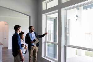
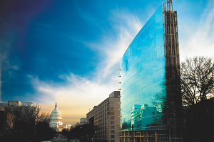
She said the first section of the Underline will go through a “dense, growing area called Brickell, which is just on the other side of the bridge over the Miami River to downtown. It’s been our financial hub, but has now turned into a hip community with lots of condos, apartments and great restaurants. But it’s not very green or walkable.”
Friends of the Miami Underline incorporated in 2014 and hopes to start building in the fall of 2017. Daly said the Brickell section of the Underline also will greatly benefit the “other side of the tracks,” which includes Little Havana, heavily Spanish speaking and has many mid- to low-income residents. She said the Underline will cost around $10 million a mile, compared to what she said will be $14 million a mile for Atlanta’s BeltLine.
“We really need something like this because Miami-Dade County is one of the most dangerous places to bike and walk in the U.S. We just don’t have quality infrastructure for people to get out safely,” she said.
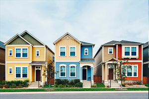
Daly predicts the “economic impact of the Underline will be impressive, with property values for ones that are close to increase 25 percent. But our impact zone is as much as a third of a mile away and even at that distance property values are expected to increase 5 percent.”
She said there is $3 billion in planned development along the Underline, which includes transit-oriented and transit-adjacent development.
“All of that has kicked into high gear as the Underline has come along and property values are already rising,” she said, noting that a design review committee is reviewing numerous developers’ plans. “We strongly believe if we don’t do things right next to the Underline — which is just 100 feet wide — we’ll be missing opportunities.”
If all goes well, Daly hopes the Underline will be built out in six years, so she can push her yet-unborn grandchildren along the trail in strollers.
The Atlanta BeltLine
In Atlanta, Paul Morris, CEO of the Atlanta BeltLine Inc. (ABI), said his organization has worked with neighborhoods since the inception of a plan that would repurpose 22 miles of an unused rail corridor into a walking and cycling loop and streetcar line.
“The original initiative involved hundreds of meetings in neighborhoods from 2003 to 2005, before the city council adopted the resolution that formed the redevelopment act,” he said.
“We met with people in the 45 neighborhoods that are adjacent to the BeltLine on either side. Linear parks are built on railroad lines that really were the dividing line for a lot of these communities, and that was the case in Atlanta as well.
“A neighborhood coalition came together and was the engine that prompted the city council to think big and embrace this notion of reclaiming the rail corridors, the industrial lands that were associated with them and converting them into 1,300 acres of new parks, linear transportation networks, housing and economic development in areas that were post-industrial.”
The economic impact of the Miami Underline will be impressive.
He said plans call for 22,000 new housing units on the trail, with at least 20 percent of them in the affordable housing category. To reach those who will be affected by the BeltLine, his organization has used what he calls a “robust social media network.
“But we discovered that in some of the more underserved neighborhoods, those technologies and platforms don’t always reach everyone. So our communications team created pop-up community events to meet with neighbors, answer questions and hand out collateral material so they can know what’s coming up.”
In addition, he said, sometimes the ABI will host Saturday resident roundtables that don’t have specific agendas. Rather, he explained, community members can ask questions and control the conversations.
Though there was some NIMBY opposition to the Belt- Line, Morris said it has been enthusiastically accepted by most of Atlanta, which is often criticized for having some of the country’s worst urban sprawl and backedup commuter traffic.
Many businesses are paying the Atlanta BeltLine for access licensing agreements to put paths to their properties.
“When the first part of the BeltLine was completed in 2012, one of the things that every resident and business asked for was a ‘good neighbor fence,’” he said. “But within six months of when we’d cleared out the corridor, all those fences were torn down because they realized it wasn’t such a bad thing.
“They want access to it now. Many businesses are paying us for access licensing agreements to put paths to their properties.
“We’re seeing REALTORS®, developers and politicians calling the BeltLine their version of waterfront property in Atlanta. There really has been, in only the past few years, a fundamental shift. Neighborhoods that were some of the most vociferous opponents are now wondering when they are going to get their section of BeltLine.”
So far, public and private investment in the project has totaled about $450 million. Approximately $53 million of that has been spent to acquire property, clean up and build parks, trails, housing and create jobs.
“This is more than transportation, open space and community development. It’s economic development, too, and we track that annually,” Morris added. By the end of 2015, we had exceeded just over $3 billion in private development.”
He hopes the BeltLine can be completed in 15 years. ABI owns about two-thirds of the 22 miles needed for the trail and 75 percent of the 1,300 acres it hopes to acquire for new parks. Seven miles of trail have been built to date and another 10 may be added in connector trails.
The BeltLine goes through every kind of neighborhood, from wealthiest to the poorest. The East Side Trail and historic Fourth Ward Park are in what was, in 2009, one of the highest crime zones in the city. Today, over the last 36 months, there has been just a total of 18 crimes reported.
Morris said that has come through a lot of effort and also the fact that 1.3 million people used the 2.3-mile section that we built. We have our own police precinct that specializes in patrolling and serving the BeltLine — both built and unbuilt segments and adjacent parks.
The police have become the face of the BeltLine to a lot of the community.
The specially trained police patrol in bicycle teams and work with fire and rescue units. “In a way, they have become the face of the BeltLine for a lot of the community,” he said. “It’s sort of like having our own mounted patrol. People like having their photos taken with the bike cops. They put additional eyes on the corridor. With them around, people know it’s safe and secure.”
Come November, Atlantans will vote on two ballot initiatives to fund much of the BeltLine, its operating costs and build and run a crosstown streetcar network. Combined, the cost would be more than $2.5 billion.
Morris said he is optimistic they will pass. “The community really has decided this is something that is important — enough so that elected officials have put it on the ballot to ask voters if it is something that they should go ahead and fund their share of,” he said.
The 11th Street Bridge Park in D.C.
In Washington D.C., Scott Kratz, executive director of Building Bridges Across the River (BBAR), said 700 meetings have been held since 2012 in neighborhoods on both sides of the proposed 11th Street Bridge Park.
He said a key part of the project is the Equitable Development Plan aimed at making sure the new park — built on piers left over from a now demolished bridge — benefits the lower-income, east side of the river. BBAR runs the Town Hall Education Arts Recreation Campus (THEARC) in the east side’s Ward 8, which is 98 percent African-American.
“The communities on the opposite sides of the Anacostia River couldn’t be more different,” he said. “The west side has the booming Navy Yard and Capitol Hill, while the communities east of the river have historically been under-invested. There is about a $390,000 difference in the value of homes on one side of the river and the other. And a $70,000 difference in annual household income. So a pretty stark discrepancy.”
Stan Jackson is president and CEO of the Anacostia Economic Development Corp., which is based on the east side of the river. He said the “inclusivity” of the planners was well received.
“Our [east side] community will experience some transformation because of this project, and that needs to be jelled into a continuum that can do something about the wide disparities that exist in education, income, jobs and housing. The bridge park can be a catalyst to stimulate development and progress.”
A key part of the project is the Equitable Development Plan aimed at making sure the new park benefits the lower-income side of the river.
Jackson said he is concerned that the gentrification of east side neighborhoods near the bridge may force some current residents out.
“There will be both challenges and benefits,” he said. “We know that. All change isn't bad, though. The key is how you manage it and having a say in what happens.”
Kratz said the project got its start when former D.C. planning director Harriet Tregoning — a champion of urban walkabilty — “saw a unique opportunity when the old 11th Street vehicular bridge had aged out. She wondered if instead of getting rid of the old infrastructure, could we save some of it and repurpose it for this public space.”
Kratz, a former vice president of education at the National Building Museum who lives a few blocks from the western terminus of the bridge, volunteered to help and spent countless hours meeting “any group that would have me.
“Basically, I was asking permission. This was especially important on the east side, because planning often happens ‘to’ lower-income communities rather than including them in the process.”
He said the Equitable Development Plan started with “building trust, which is a fragile thing. We wanted to make it responsive to the tens of thousands of neighbors who would be affected by the park because we know these big projects can have unintended consequences. Typically we bemoan the effects of gentrification after it’s too late to do anything about it.”
The park — which will be 1,200 feet long, 180 feet wide at the west side expanding to 187-feet wide on the eastern end — will attract an estimated 800,000 to 1.2 million visitors a year when it is opened.
“We turned to the community early on and asked for ideas to make sure this civic space would boost the local residents,” Kratz said. “At the end of that 18-month process, we posted the recommendations online and then announced 19 final proposals in three categories of workforce development, small business and housing, which will include new and rehabilitated dwellings.
“We’ll build on parking lots east of the river as well as other empty lots for a mix of market-rate and affordable housing in what is a historic district.
“We’re also funding a home-buyers club for people east of the river to boost financial literacy for residents and provide access to capital for those who are interested in buying to capture some of that rising equity and stay here.
“We wanted to hit this early before property values start to go up. If you own your house, that’s great, but it you are part of the 75 percent east of the river who rent, there is the potential to be displaced. We wanted to get a jump on this before the market takes over.”
Katz’s group has raised $15 million out of a total goal of $45 million to date.
“It’s enough to begin pre-construction and that’s pretty exciting,” he said. “We’re doing everything from permitting and right-of-way and further design work. We hope to begin construction in 2018 and the earliest we’d open up is 2019.”
Burke-Gilman Trail in Seattle
In Seattle, the 12-mile-long Burke-Gilman Trail begins in the Ballard neighborhood on Puget Sound, goes through the University of Washington campus, continues north on Lake Washington and east into King County, and links with another 25 miles of additional bike and pedestrian paths. Started in 1978, it is considered one the granddaddies of all urban trails in the United States.
Peter Lagerwey, who was a project manager for the city on many of the trail segments, said several pieces were already in place before he moved to Seattle in 1984.
“More than 1 million people rode their bikes and walked on it this year, making it one of the most heavily used trails in the United States,” he said. “So it’s been a great success.”
He said he worked with numerous neighborhood groups and businesses on the trail and agreements were reached with all of them except for several in an industrial district of Ballard.
As a result, there is a missing link of 1.5 miles that have been blocked by several lawsuits and injunctions, the last of which required a full environmental impact statement (EIS) on the trail.
More than 1 million people rode their bikes and walked on the Burke-Gilman Trail this year.
“The EIS is out now and there is a window for people to appeal in court, and I suspect they will,” he said. “The city already owns the land, but the businesses say the trail would conflict with their truck traffic, so cyclists still have to ride in the street.
“The city will prevail eventually, this just adds to delays and costs. We did lots of planning and meetings with people, but opponents have used the courts to block what almost everyone would agree is a great trail and a real benefit to the city and its residents.”
Like the linear parks themselves, the process of creating these urban developments can move from inspiration to discussion to planning and even litigation, but backers and residents agree the journey is worth the work.